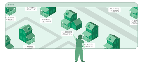
Convert coordinates to and from places
Worldwide · Affordable · Reliable · Open Data
Why OpenCage?
A trusted partner
- Thousands of satisfied customers worldwide, tens of millions of API requests per day
- Here today, here tomorrow. Funded by customers, not VCs - since 2013
- Redundant EU data centers, fully GDPR compliant
- Independently monitored uptime
- All API requests via 256-bit SSL encryption (HTTPS)
- Responsive customer support. Ask us anything
- Proud corporate member of the OpenStreetMap Foundation
Great product
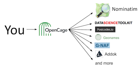
- Many open gecoders behind a single API
- Most permissive licensing in the industry
- Cache results as long as you like
- No vendor lock-in, display results on ANY map
- Worldwide coverage
- Continual updates - OpenStreetMap has over four million edits/day

Using open data has many benefits, doing it via OpenCage means one less thing for us to maintain.
Robert Theml
·
Director
·
SIXT Share
Less maintenance
- Avoid the stress and on-going costs of maintaining your own system
- Easy setup: Tutorials and SDKs for over 30 different programming languages
- Data enrichment with useful info like timezones, Wikidata ids, NUTS codes, FIPS codes, speed limits, UN/LOCODEs, what3words, etc
- Well-formatted address strings so your users understand where they are - see why this matters
Affordable, predictable, transparent pricing
- Generous free testing tier
- No credit card required at sign up
- Subscription and one-time plans
- No tricks. Cancel anytime, for any reason
- No surge or usage charges
- No long term commitment. Pay as you go
- Secure payment in all major currencies
- See pricing

Great value for money, and a responsive team. OpenCage has been a reliable partner as we've grown MileCatcher
Lars Boesen
·
Founder
·
MileCatcher
See how OpenCage is used in your industry
Who builds OpenCage? And why?
Our mission: to make using open data easy, dependable, and much more affordable than proprietary geocoders.
Learn about the advantages of open data, the team behind the API, and how we give back to the open geospatial community.
Questions?
Please get in touch or have a look at our FAQ
This image shows the node density of OpenStreetMap data in summer 2015.
It's one of many data sources we use.
Data © OpenStreetMap contributors, Imagery © Martin Raifer, cc-by
Open as larger interactive map
It's one of many data sources we use.
Data © OpenStreetMap contributors, Imagery © Martin Raifer, cc-by
Open as larger interactive map


